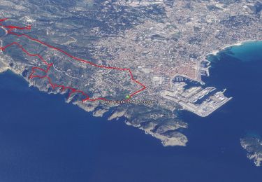
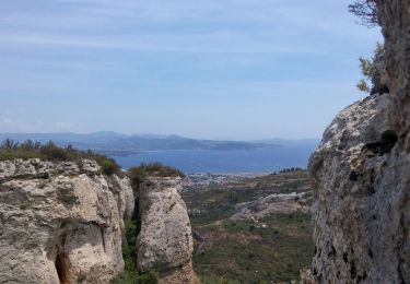
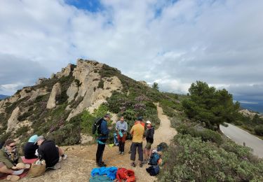
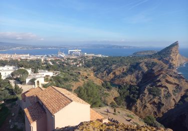
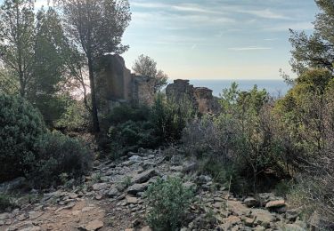
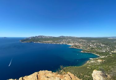
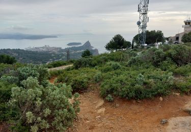
Randonnée Marche La Ciotat - RB-la_ciotat-cassis - Photo
 raymondfn
raymondfn

Utilisateur

© OpenStreetMap contributors
Longueur
Longueur
12,7 km
Altitude max
Altitude max
380 m
Dénivelé positif
Dénivelé positif
647 m
Km-Effort
Km-Effort  
21 km
Altitude min
Altitude min
6 m
Dénivelé négatif
Dénivelé négatif
664 m
Boucle
Boucle
Non
Date de création :
2014-12-10 00:00:00.0
Dernière modification :
2014-12-10 00:00:00.0

(0 Avis)

Marche
Marche
4h59
Difficulté : Moyen

Scannez ce code QR pour ouvrir la randonnée dans l'application SityTrail

Application GPS de randonnée GRATUITE

Logo SityTrail SityTrail

IGN / Instituts géographiques

Télécharger SityTrail sur l'App Store Télécharger SityTrail sur Google Play

Logo SityTrail SityTrail World

Le monde est à vous

Télécharger SityTrail sur l'App Store Télécharger SityTrail sur Google Play Télécharger SityTrail sur Huawei AppGallery

À propos

Randonnée Marche de 12,7 km à découvrir à Provence-Alpes-Côte d'Azur, Bouches-du-Rhône, La Ciotat. Cette randonnée est proposée par raymondfn.

Description

La Ciotat (rue Mugel), anse de Figuerolles (A-R), chapelle Notre-Dame de la Garde (A-R vue sur la Ciotat), carrière de la Vigie, sémaphore du Bec de l'Aigle, sentier au sommet des falaises (vue permanente) Cap Canaille, Baume Noir des Espagnols, pas de la Colle, vue sur les vignobles (le Revestel), Cassis (port).

Profil altimétrique

Localisation

Pays :
France
Région :
Provence-Alpes-Côte d'Azur
Département/Province :
Bouches-du-Rhône
Commune :
La Ciotat
Localité :
Unknown
Départ:(Dec)
Départ:(UTM)
711766 ; 4782668 (31T) N.

Randonnées à proximité

Randonnée Marche La Ciotat - La Ciotat - Chapelle Ste Anne - Ruines villas - Semaphore - Bau Rous - Pont naturel - Dent du chat - Photo
Marche
GUIDE
affinetataille

Marche

Difficile
(1)
La Ciotat, Provence-Alpes-Côte d'Azur, Bouches-du-Rhône, France
12,1 km | 19,9 km-effort
7h 30min
Oui
Randonnée Marche La Ciotat - la ciotat - Photo
Marche
Berrangerannick

Marche

Très facile
(1)
La Ciotat, Provence-Alpes-Côte d'Azur, Bouches-du-Rhône, France
6,2 km | 9,3 km-effort
3h 21min
Oui
Randonnée Marche La Ciotat - Balade La Ciotat  - Photo
Marche
BADEY

Marche

Difficile
(1)
La Ciotat, Provence-Alpes-Côte d'Azur, Bouches-du-Rhône, France
8,8 km | 14 km-effort
3h 7min
Oui
Randonnée Marche La Ciotat - Cap Canaille - Photo
Marche
DanielROLLET

Marche

Moyen
(1)
La Ciotat, Provence-Alpes-Côte d'Azur, Bouches-du-Rhône, France
10,2 km | 16,2 km-effort
4h 0min
Oui
Randonnée Marche La Ciotat - Traversée Philémon au Cap Canaille  - Photo
Marche
meunier.ph.

Marche

Très difficile
La Ciotat, Provence-Alpes-Côte d'Azur, Bouches-du-Rhône, France
3,6 km | 7,6 km-effort
4h 30min
Non
Randonnée Marche La Ciotat - ND de la Garde depuis le Sémaphore 4.1.24 - Photo
Marche
GUIDE
fredetpascale

Marche

Moyen
La Ciotat, Provence-Alpes-Côte d'Azur, Bouches-du-Rhône, France
7,6 km | 12,4 km-effort
3h 20min
Oui
Randonnée Marche La Ciotat - Sémaphore bec de l'Aigle, la Ciotat, 04-10-23  - Photo
Marche
Christiancordin

Marche

Moyen
La Ciotat, Provence-Alpes-Côte d'Azur, Bouches-du-Rhône, France
13 km | 19,6 km-effort
3h 53min
Oui
Randonnée Marche La Ciotat - La Ciotat Cassis par la falaise cap canaille  - Photo
Marche
GUIDE
antignacs

Marche

Facile
La Ciotat, Provence-Alpes-Côte d'Azur, Bouches-du-Rhône, France
7,6 km | 14 km-effort
3h 47min
Non
Randonnée Marche La Ciotat - la ciotat ND la garde vers le sémaphore par les chemins  - Photo
Marche
ego

Marche

Moyen
La Ciotat, Provence-Alpes-Côte d'Azur, Bouches-du-Rhône, France
3,6 km | 7 km-effort
1h 29min
Non


Fermer
Mes abonnements